Research Vessel
RICHARDSON POINT
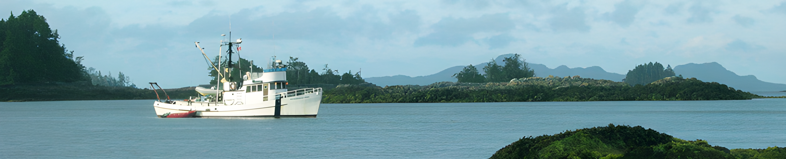
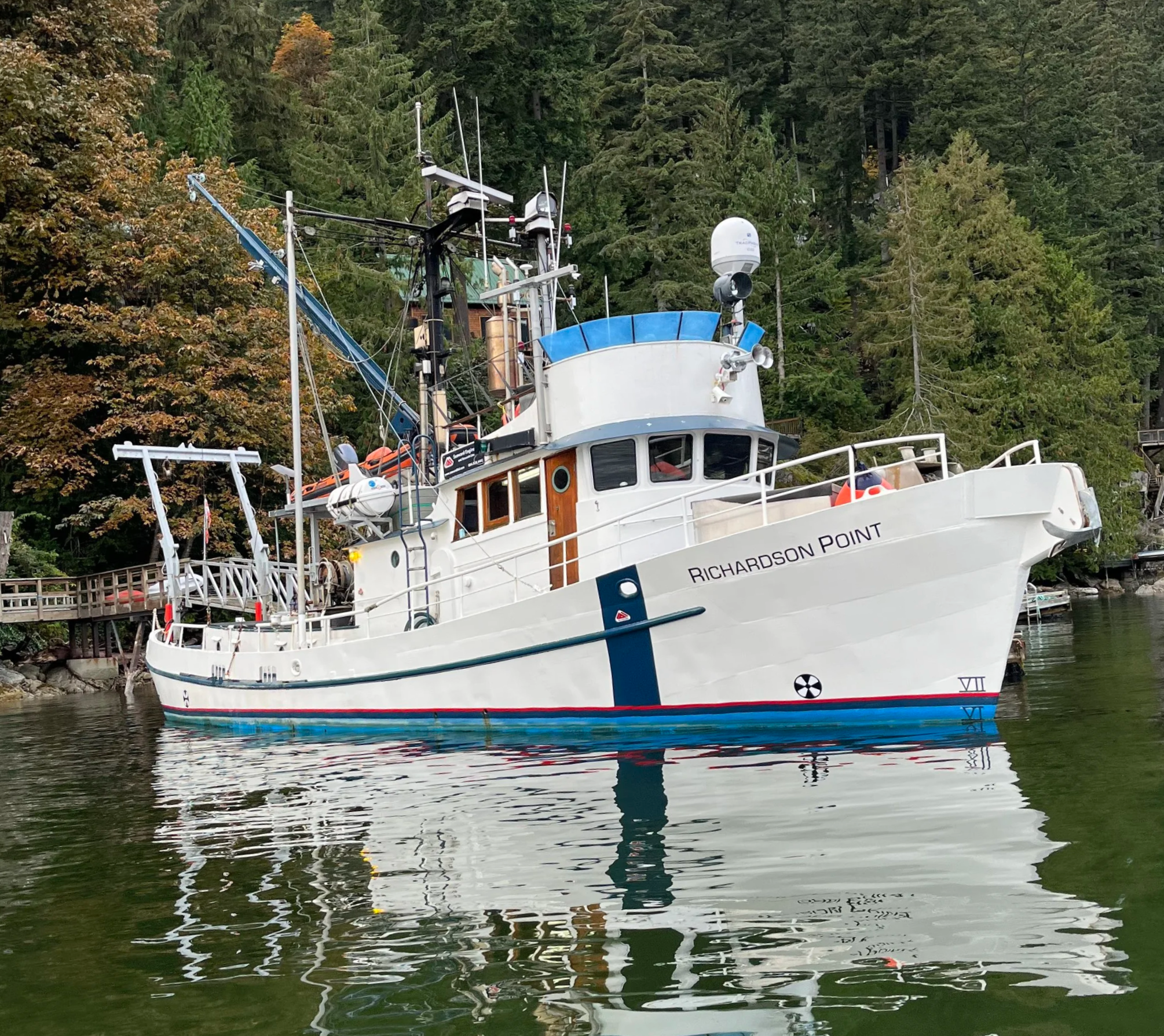
SER's primary research vessel, the Richardson Point operates as the hub of operations and the major platform for research and data collection projects.
ABOUT
The RP, formerly the "Richardson", was built and operated by the Canadian Hydrographic Service department of the Canadian Government from 1962 to 1991 and served along the BC coast and in the Canadian Arctic as a marine research and survey vessel. Her Arctic work included surveying much of the Mackenzie Delta, as well as assisting with setting up of the Distant Early Warning (DEW) line.
The RP provides SER with an ideal research platform to carry out our marine operations, from dedicated hydrographic survey operations to multi-task assignments including ROV and dive operations.The RP is operated by a qualified and experienced crew and is Transport Canada certified.
Ownership Seaward Engineering and Research Ltd.
Port of Registry Victoria BC
Built 1962
Length 20 m (66 Feet)
Beam 5.5 m (18 Feet)
Gross Tons 59 Tons
Normal Crew 2 to 4
Berths 9 Permanent / 3 Additional
Range 7000 Km (3800 N. Miles)
Endurance 20 days at 10 Knots Cruising Speed
COMMUNICATIONS
GMDSS and VHF Radios
SSB Radio
Cell Phone
Fax
VSAT Gyro Stabilized Satellite Phone
and Data Link with onboard WIFI
Starlink Internet
STANDART EQUIPMENT
1,5 Tons Hydraulic A-Frame (Stern Mounted)
1 Ton Derrick Boom
Universal winch mount
Hydraulic Quick Connects for Various Equipment
Compressed Air (100 psi)
Compressed Air for Scuba (Upon Request)
120 Volt AC Power
220 Volt (Upon Request)
Fresh Water on Deck
High/Low Volume Seawater on Deck
LIFE SAVING APPLIANCES
EPIRB 406 MHz and 121.5 MHz (Self Deploying with GPS)
Automatic Distress tone broadcast on sSB
2 – 16 Man Self-inflating Life Raft (A-Pac)
16’ RIHB c/w 60 HP Outboard and Lifeboat Kit
12 Immersion Suits
20 Standard Adult Life Jackets (Additional Available)
Level 2 First Aid kit
Flares and Safety Equipment In Compliance with Transport Canada Regulations
ACCOMODATION
Full Galley with Stove, Fridge and Freezer
One (1) Forward and One (1) Aft Head
One (1) Shower

THE HISTORY OF
RV RICHARDSON POINT
The C.H.L. (Canadian Hydrographic Launch) "Richardson" was launched at the Star Shipyards, New Westminster, on 31 March 1962. Mr R.B. Young, Regional Hydrographer, made a brief but pertinent speech. Mrs. Young then stepped forward and said, "I name this vessel 'Richardson', God bless her, and all who sail in her". She then swung the champagne bottle mightily, and duly christened the vessel.
❋ The launch was named after (or for) Sir John Richardson, explorer of the Canadian North during the mid-nineteenth century.
❋ Registered at Ottawa, No. 318526, the C.H.L. "Richardson" was formally accepted on 18 May 1962, by Mr. R. F. Swain on behalf of the Canadian Hydrographic Service, following successful trials on the West Coast.
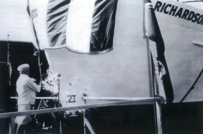
Ceremonial christening of the Richardson.
❋ "Richardson" is not a very large vessel, and certainly seems mighty small when a voyage into the high Arctic is considered, but she is compact and appears well built and should prove adequate to do the job for which she was designed. She was fitted with all the latest electronic navigational equipment, and is capable of steaming in excess of 2000 miles without re-fueling.
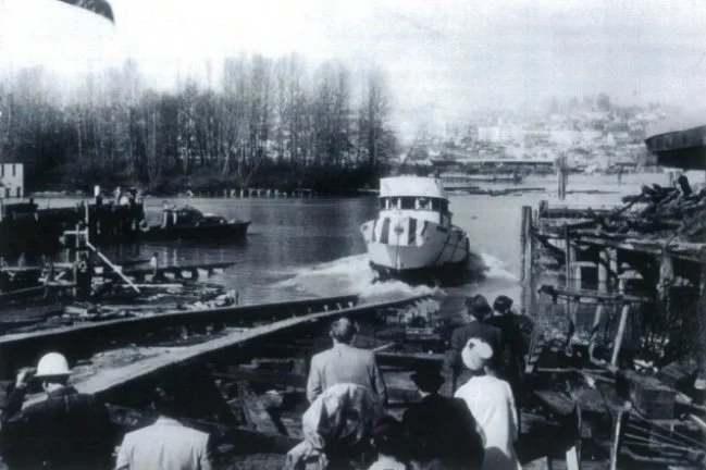
The Richardson touches the water for the first time to start her long and celebrated career at sea.
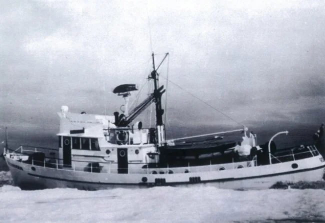
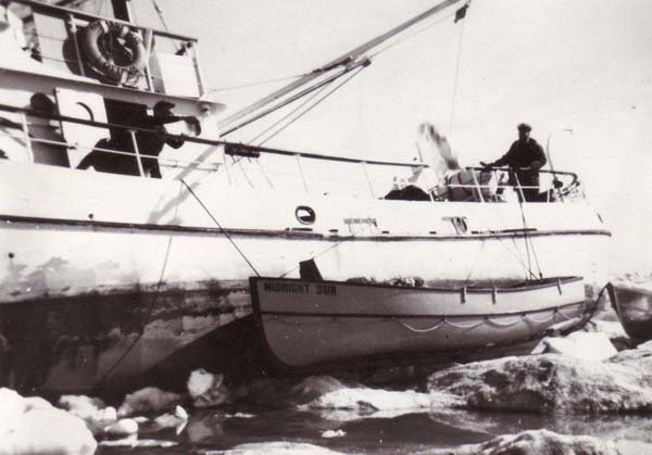
The Richardson in the pack ice.
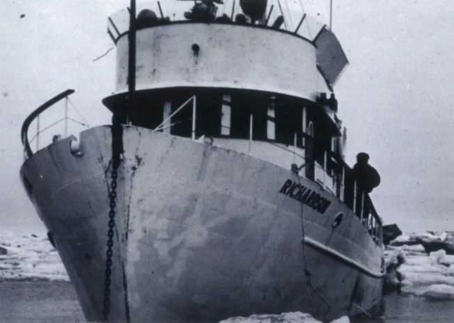
The Richardson and her crew in the ice.
❋ Her first Master and Hydrographer-in-Charge was Mr. T.D.W. McCulloch.
Her normal complement consist of two hydrographers, one of whom will be in command of the vessel, a ships engineer and three crew members. Additional bunk space provided for two more persons for short term projects and in cases of emergency.
The "Richardson" was started her maiden voyage for Alaskan waters about the 1st July 1962.
❋ The CSS Richardson was far more than a survey vessel—it was a resilient and essential workhorse of Canada’s Arctic exploration era. Operated by the Canadian Hydrographic Service, the ship played a critical role in charting some of the most remote and hazardous waters in the North.
Beyond its early work in the Mackenzie River Delta, CSS Richardson contributed to a wide range of hydrographic and mapping projects across northern Canada. Its surveys produced some of the first accurate nautical charts of Arctic waterways, significantly improving navigation safety for both government and commercial vessels.
In addition to its mapping achievements, the vessel supported logistical and survey operations related to the Distant Early Warning (DEW) Line, a key Cold War defense network stretching across the Arctic.
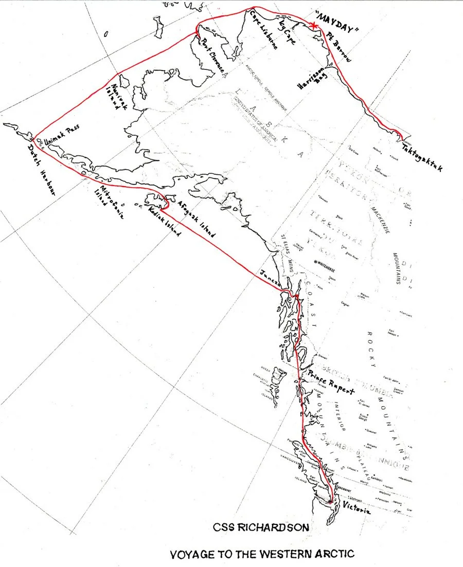
Map of her Voyage into the western arctic C.S.S. Richardson - July 1967.
From Final Field Report 1967 by T.D.W. McCulloch.

Into the Arctic
In the summer of 1967, Richardson undertook a demanding voyage from Victoria through Alaska and into the Arctic Ocean. The journey, intended to support hydrographic surveying operations, quickly turned into a test of endurance as the vessel encountered severe weather, mechanical failures, and dense Arctic ice.
While navigating near Point Barrow, Richardson became trapped in heavy pack ice. The situation escalated dramatically as shifting ice floes exerted immense pressure on the vessel, causing dangerous tilting of up to 35 degrees.
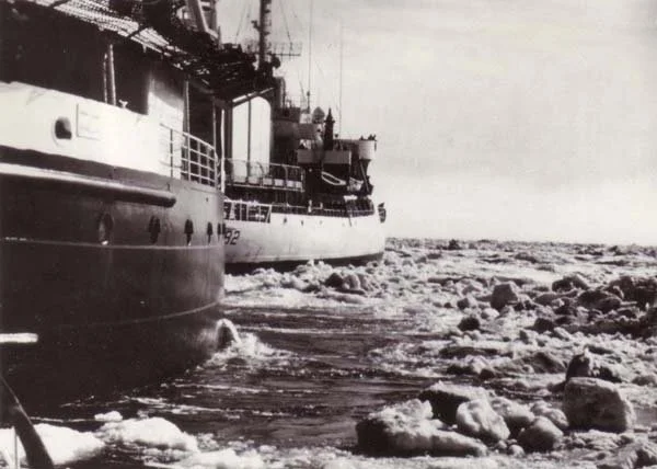
Despite the extreme conditions, the crew remained aboard, determined to save the vessel. Emergency signals were sent, and assistance arrived from Canadian and U.S. icebreakers, including the CCGS Camsell and USCGC Northwind.
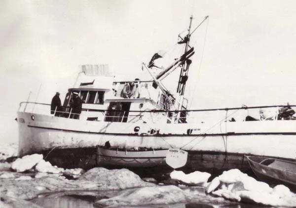
A 14,000 Horsepower Rescue
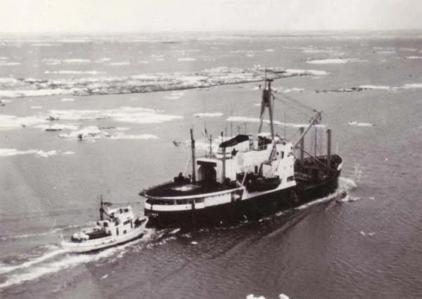
In a remarkable display of coordination and power, the two icebreakers worked together to free Richardson. Towed through thick, rafted ice in a rare tandem operation, the combined force of over 14,000 horsepower dragged the damaged vessel to safety.
However, the ordeal left its mark—Richardson suffered a severely damaged propeller, steering failures, and structural impacts from the ice. Even after being freed, the vessel endured a difficult tow along the Arctic coast toward Tuktoyaktuk, battling further ice pressure and mechanical breakdowns.
Legacy of Resilience
Richardson finally reached Tuktoyaktuk on August 1, where it entered drydock after one of the most challenging voyages in its history.
This mission stands as a powerful example of Arctic seamanship, perseverance, and the critical importance of hydrographic work in extreme environments. The data collected and experience gained during such voyages contributed significantly to safer navigation and a deeper understanding of Canada’s northern waters.
Through its work in coastal mapping, seabed analysis, and environmental data collection, CSS Richardson helped lay the foundation for future offshore exploration and northern infrastructure development, leaving a lasting legacy in Canada’s Arctic history.